
An Urban
Development
May 2024-
Develop and apply professional skills in design thinking, design drawing, and design writing to produce an urban development on a chosen plot of land. Design will adhere to social, physical, and regulatory contexts, placing importance on understanding restrictions of design. The portfolio will include a selection of analysis drawings, 3D building envelopes, master plans, floor plans, street sections and a series of sketches demonstrating development of design.
-
My design approach involved thoroughly analyzing all factors that may prove impeding to our design. This resulted in a clear relationship between research → constraints → design decisions. After fully understanding the constraints of the site, I gained an idea of the necessities of the neighborhood and community, allowing me to cater my design of the site.
Analysing the Plot
Developing a large-scaled urban project required an extensive analysis of the neighbourhoods social, physical, and regulatory context. Emphasis was placed on understanding existing planning policies and legislative framework restricting development. Through conducting extensive research and physical visits to the site, the opportunities and constraints of the site are demonstrated in a series of diagrams that provide a solid foundation for development.
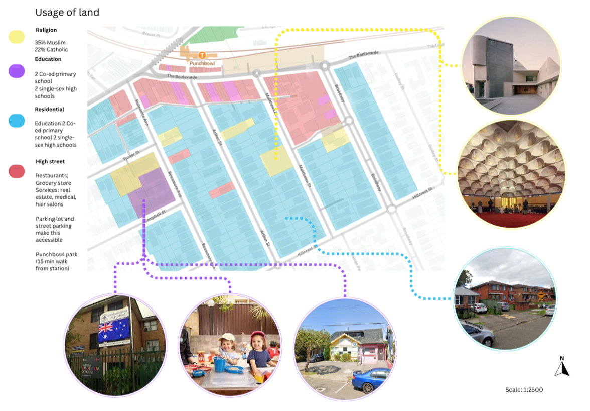
This diagram examines the distribution of land usage on and surrounding the chosen site. The relationship between several types of infrastructure is highlighted and clearly distinguished, helping to map key amenities and patterns of movement within the neighbourhood. Referenced photographs provide real-world examples of infrastructure and institutions of the area to allow the viewer to further understand the social character of the surrounding neighbourhood.
Usage of Land
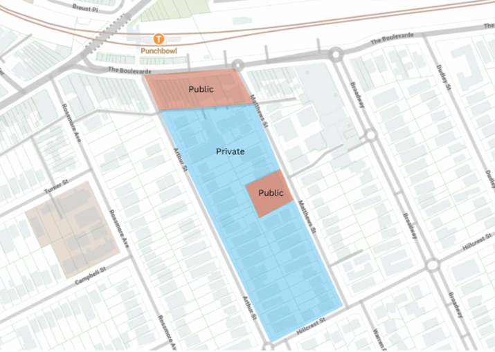
The adjacent diagram separates the site into two categories with largely differing spatial dimensions. As shown, the amount of publicly accessible space within the zones is very limited. To develop a community centre and hub within the site, this ratio would have to be drastically changed.
Public vs Private Domain
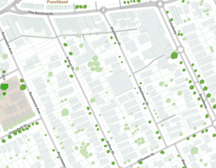
The adjacent diagram depicts the site and surrounding area’s distribution and density of tree canopy cover. The underlying base map has been saturated and simplified to place focus on the vegetation and greenery within context. Consistent graphic language is used to express trees at different scales and densities. The diagram presents an easily understandable and readable pattern across the whole neighbourhood.
Tree Canopy and Green Space
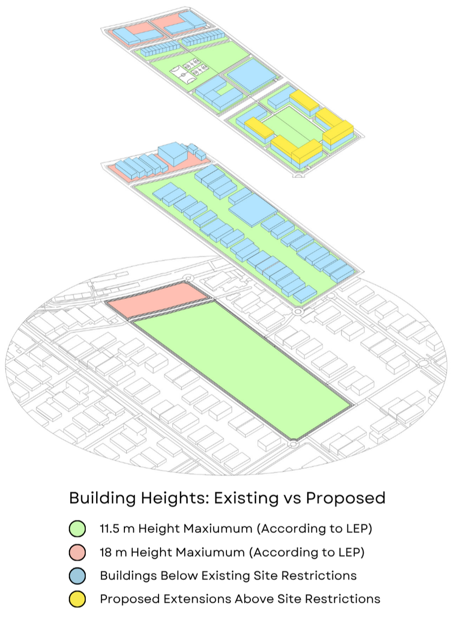
The brief required an in-depth understanding of policies and laws that determine the extents of creative freedom within design. The adjacent diagram uses four distinct and primary colours to differentiate existing policy measures against proposed extensions. The axonometric view enables the viewer to visualise both the existing context, and the proposed urban development adjacent to each other. A necessity for the brief, understanding existing policies required detailed research to arrive at a final design that adhered to building laws.
Building Height Restrictions
Master Plan Diagrams
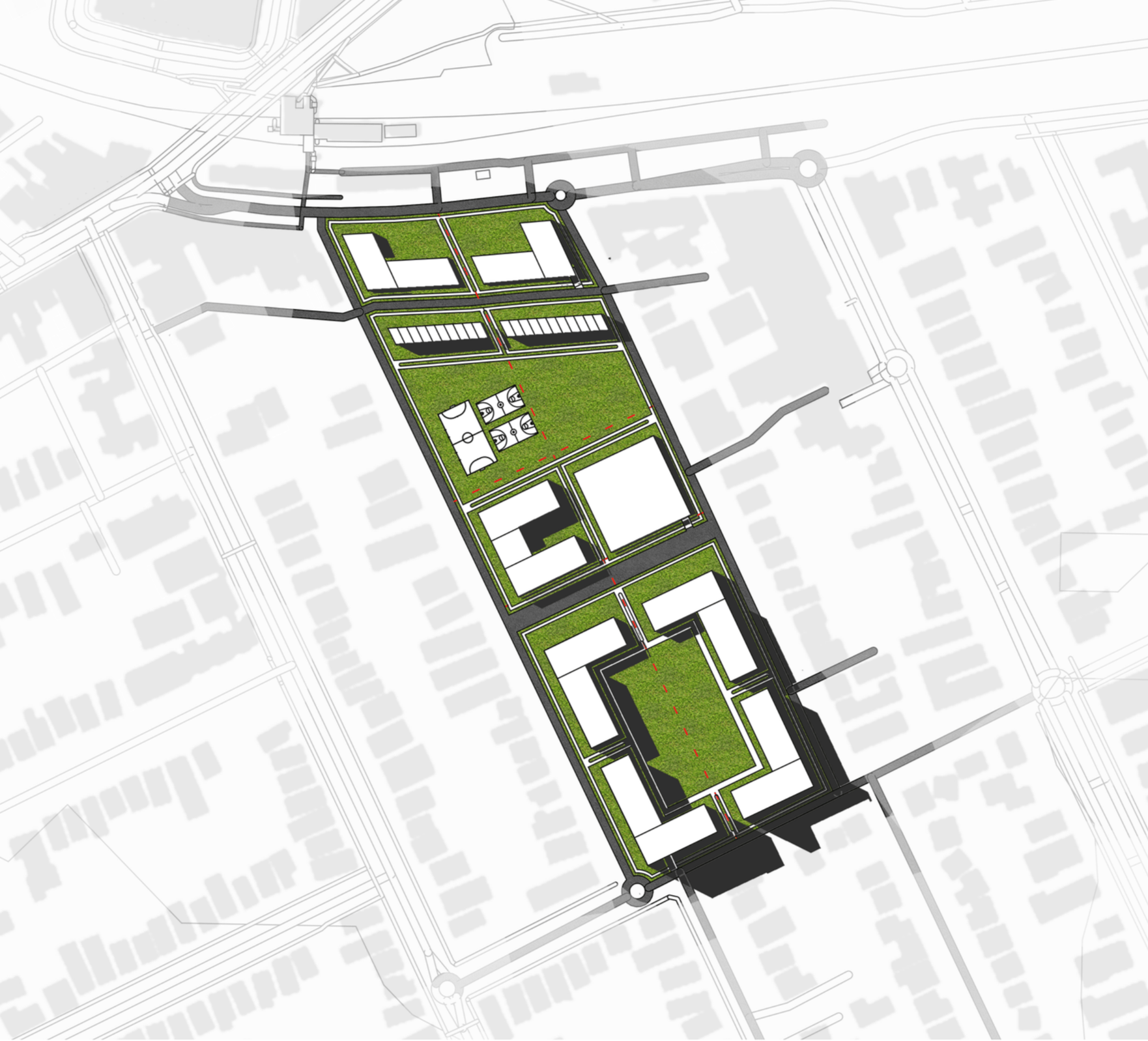
A series of master plan diagrams were developed to provide a final realisation of the sites forms, open spaces, and how they interact in different contexts.
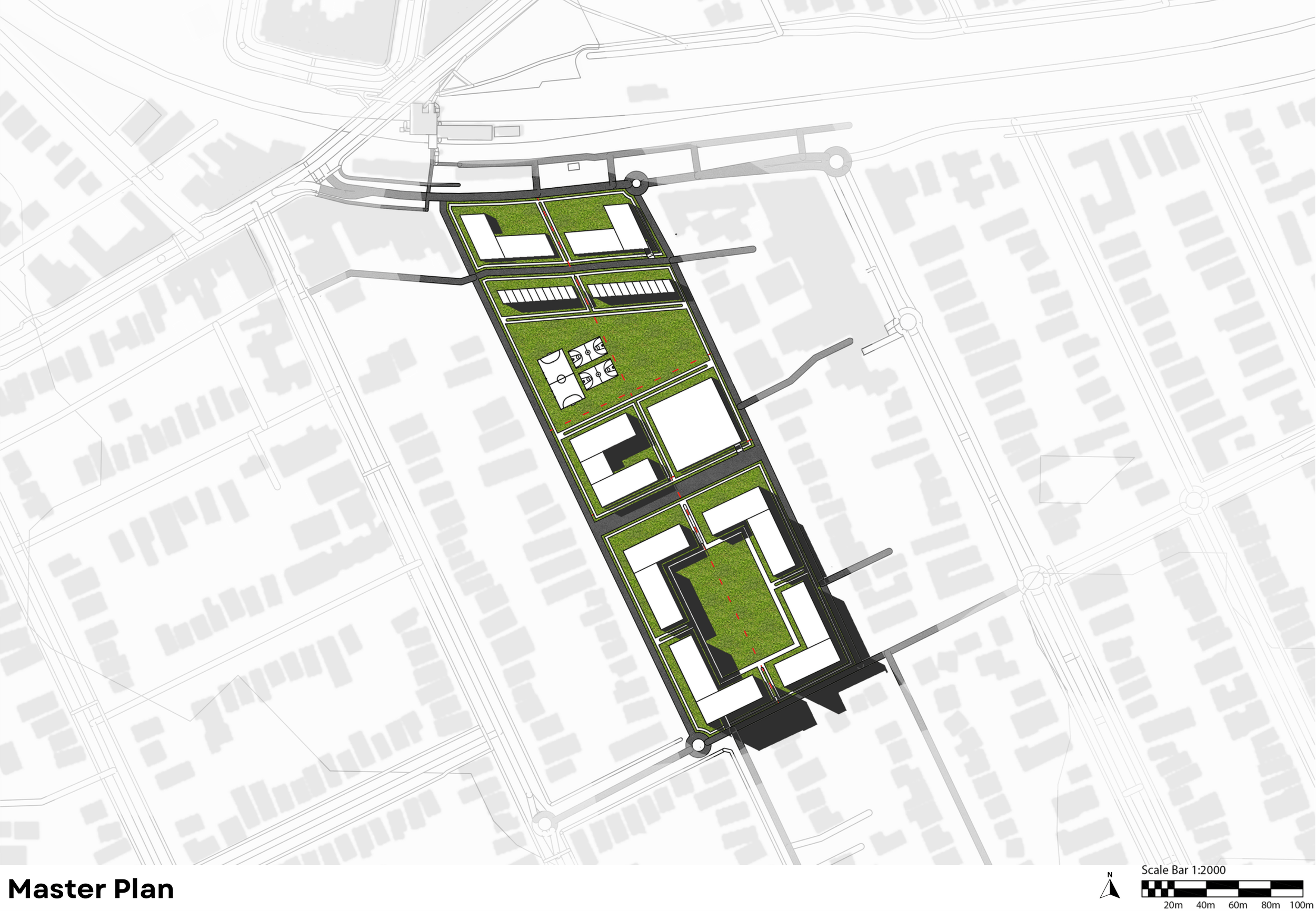
Master plan depicting main forms of the development and emphasising public green spaces
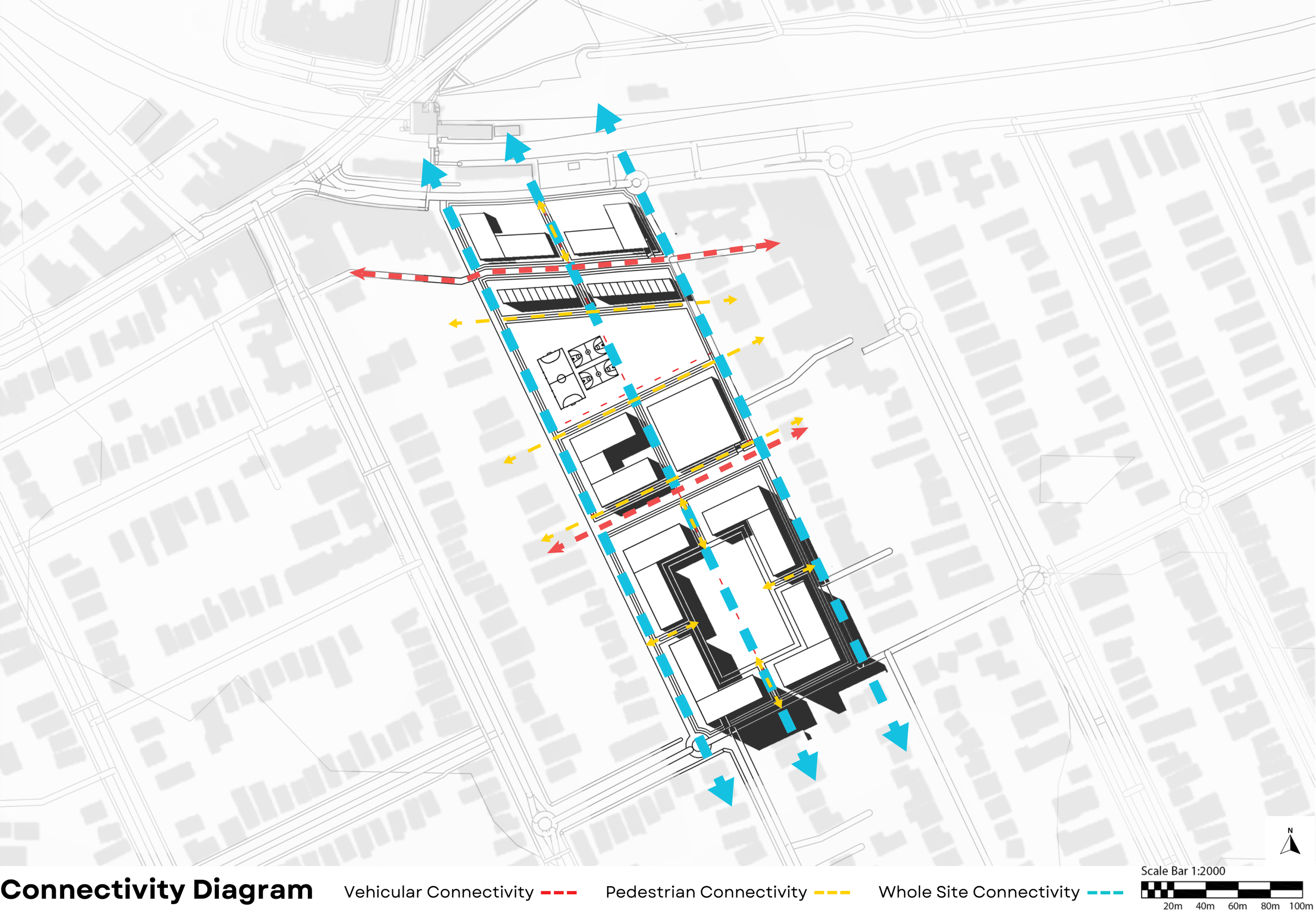
Connectivity diagram depicts the ease of traversal of the site, catering to all modes of grounded travel
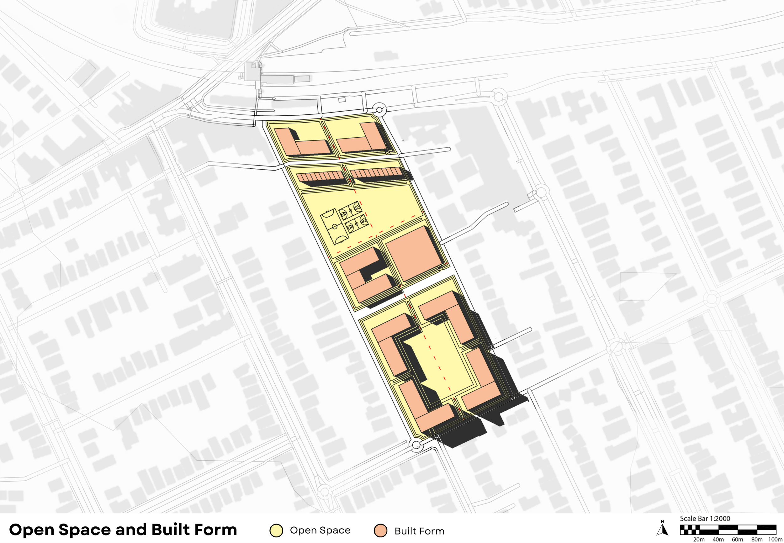
Diagram depicts the relationship between open space and built form, showing a stark difference to the original site
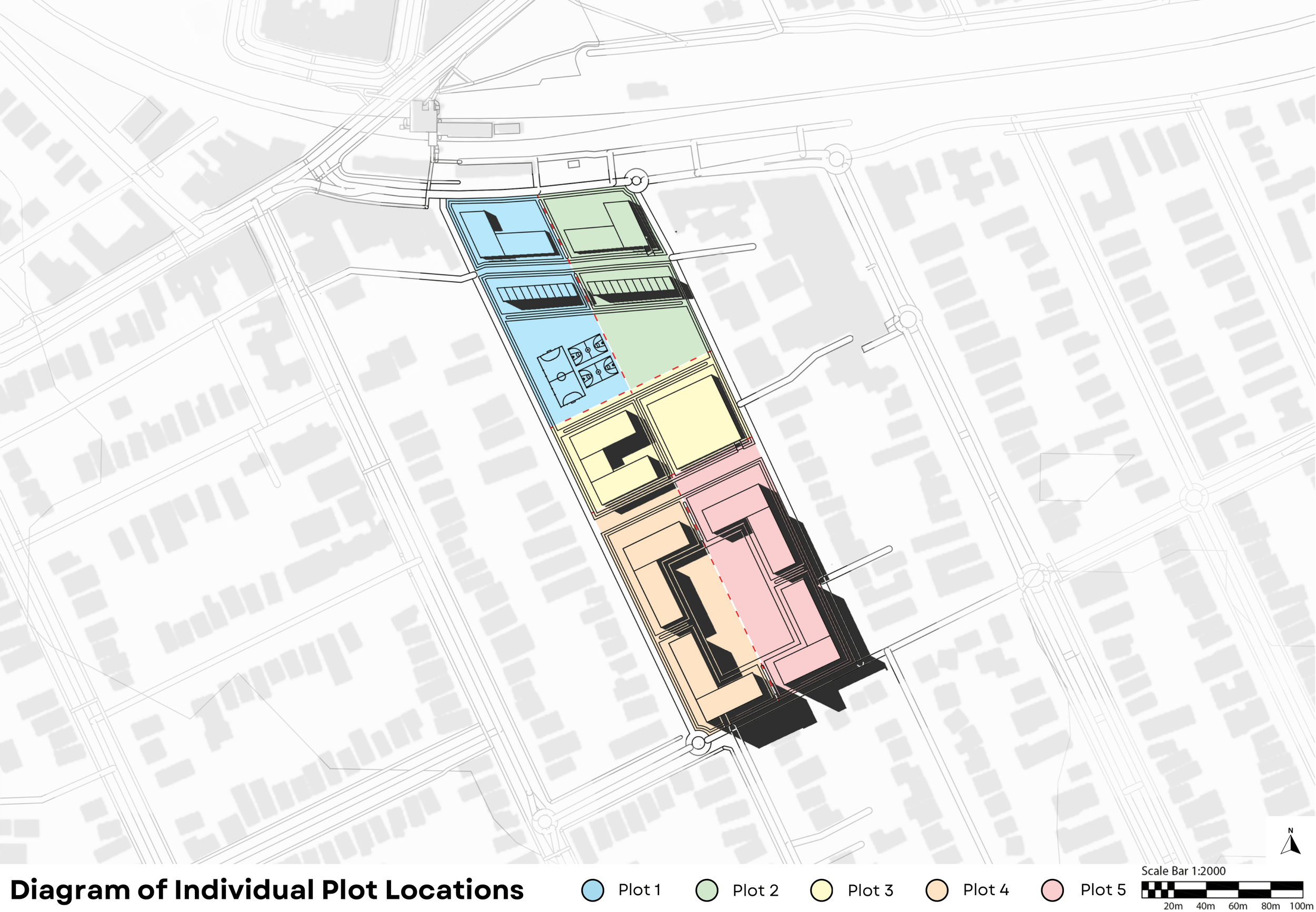
Diagram differentiates the site into five different sections, all demonstrating different purposes
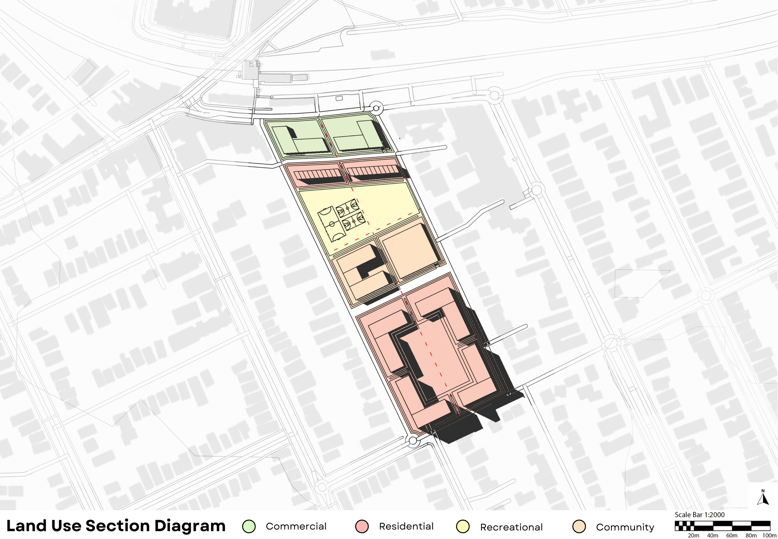
Land use diagram, employing different colours to differentiate between functions of different infrastructure
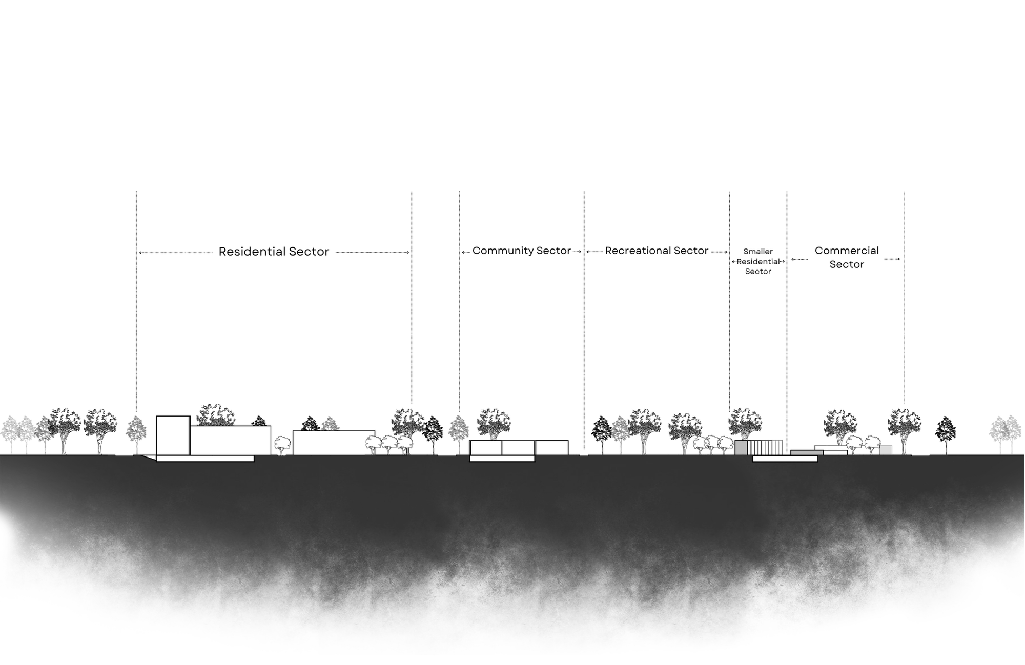
Long section depicting scale of the site from different context
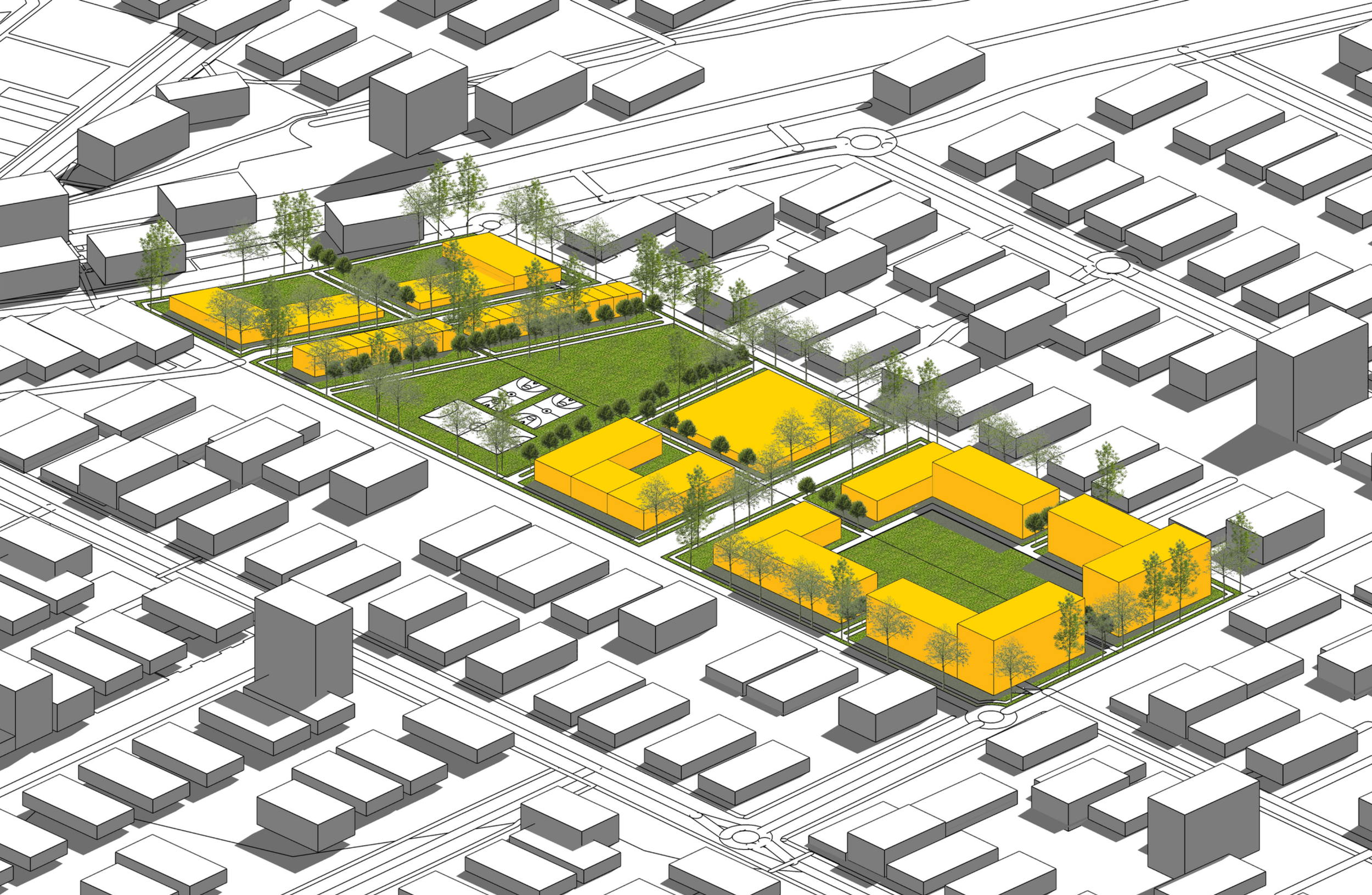
Whole site axonometric view, highlighting main forms in green context